Superior and the Coalton Prairie Corridor
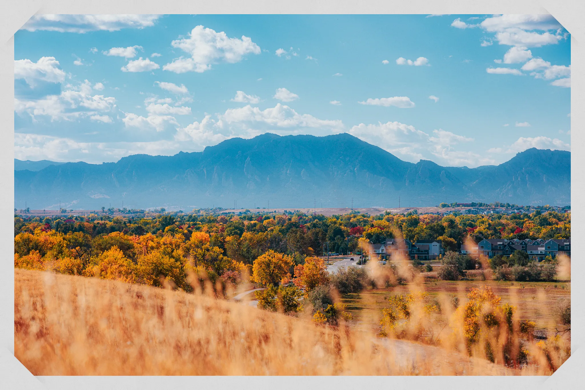
Superior is a small town tucked between Louisville and Boulder, and its open spaces deliver some of the cleanest Flatirons views on the Front Range. The Coalton prairie corridor stretches west from town into rolling grasslands where the mountain panorama fills your entire field of vision. It is the kind of wide-open landscape that makes Colorado photography feel effortless.
South Rock Creek Open Space
South Rock Creek Open Space is Superior's premier photography location. The 3.5-mile loop trail winds through rolling prairie hills with the Flatirons dominating the western horizon. Unlike locations closer to Boulder where the rock formations loom overhead, here you see them from a distance that lets you take in the full sweep of the formation, from the First Flatiron to the southern slabs.
The rolling terrain is the key to why this spot works so well for photos. As you walk the loop, the gentle hills create natural foreground interest and depth. Position your subjects on a slight rise with the Flatirons behind, and the composition practically builds itself. The open prairie means no trees blocking the light and no visual clutter competing with your subjects.
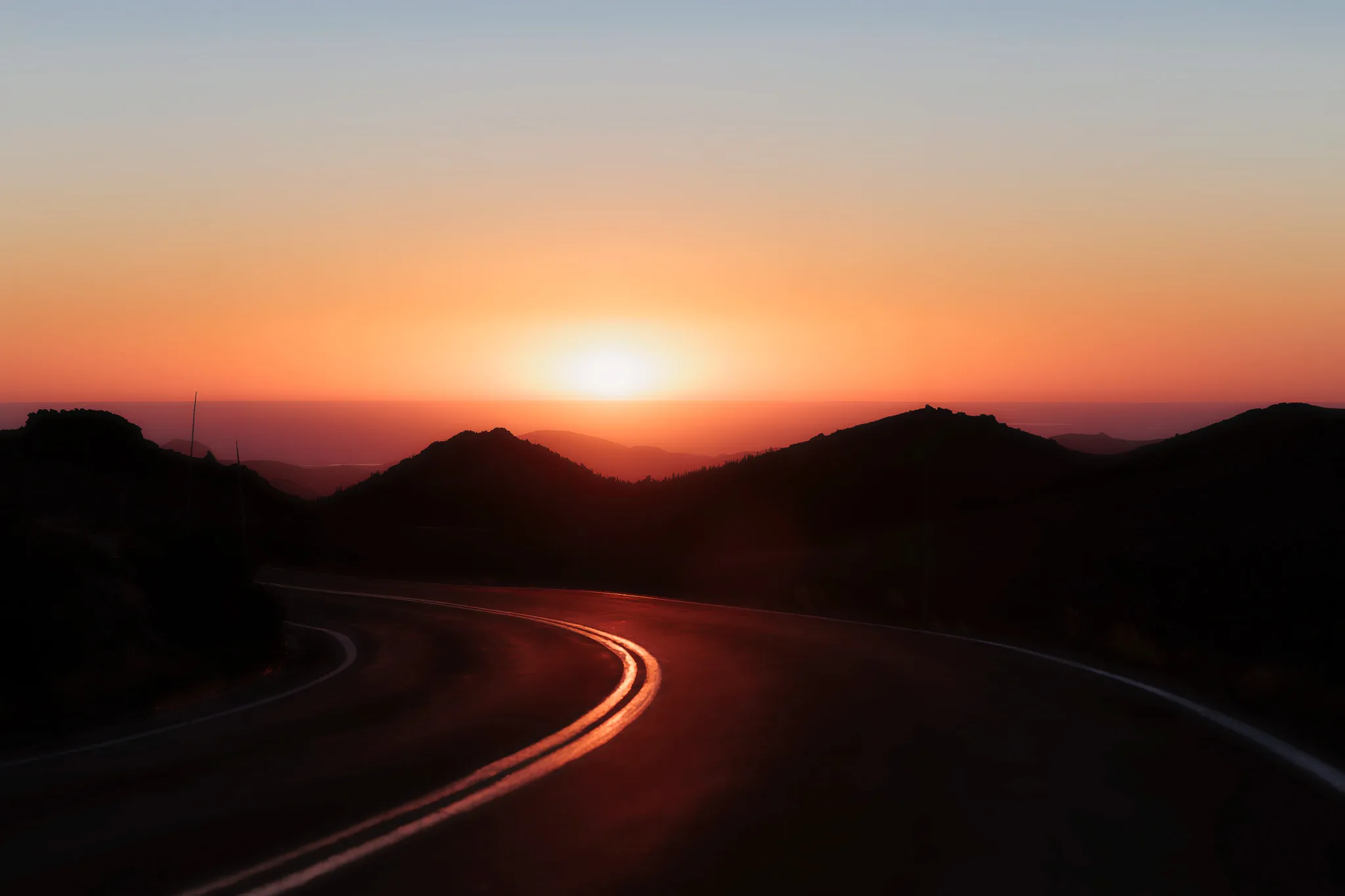
Golden hour here is exceptional. The sun sets behind the Flatirons, and the entire prairie lights up in warm tones. The grass shifts from green (spring and early summer) to gold (late summer and fall), and both versions photograph beautifully against the rock formations. This is one of those locations where I can shoot for an entire session without changing spots, just by shifting angles as the light moves.
Coalton Trailhead and the Prairie Trails
The Coalton Trailhead is managed by Boulder County and sits on Superior's western edge. From here, you access a network of grassland trails: the Coalton Trail, the Mayhoffer Singletree Trail, and the Meadowlark Trail. These trails head west into open prairie with the Flatirons growing larger as you walk toward them.
The grassland here is native prairie, and it has a different feel from the manicured open spaces closer to town. The grass is taller, the terrain is more textured, and the wildlife is more active. I have seen coyotes, raptors, and prairie dogs on nearly every visit. For photography, the tall native grass creates beautiful foreground texture, especially when backlit during golden hour.
I use the Coalton trails for clients who want a wilder, more natural feel than a city park can provide. The trailhead is five minutes from downtown Superior, but once you are on the trail, the suburban landscape disappears and you are in open rangeland with mountains ahead.
Community Ditch Trail
The Community Ditch Trail follows a historic irrigation canal between Superior and south Boulder. The City of Boulder describes it as offering "some of the most glorious views" in the entire Boulder trail system, and I agree. The trail runs along an elevated ditch bank with panoramic views of the Flatirons, the Indian Peaks, and the plains stretching east.
For photography, the elevated position gives you a natural vantage point. Your subjects are silhouetted against the sky and mountains, and the water in the ditch (when flowing, typically spring through fall) adds a reflective element at your feet. The trail is 3.5 miles one way and mostly flat, with packed gravel surface. I access it from the Superior end for the best mountain views.
Rock Creek Regional Trail
The Rock Creek Regional Trail runs 12 miles from Superior through the Carolyn Holmberg Preserve (Stearns Lake) and into Lafayette. It is fully paved and flat, making it one of the most accessible trail options in the area. The Superior section passes through open space with mountain views and connects to neighborhood parks along the way.
I use the Rock Creek Trail as a connector between locations or for clients who need fully paved, level terrain. It is excellent for family sessions with strollers, seniors who want a comfortable walk, or anyone who wants trail scenery without a real hike. The views are not as dramatic as South Rock Creek or Coalton, but the accessibility is hard to beat.
Purple Park
Purple Park (formally Superior Town Center Park) is a small community park with two ponds, a creek, and large shade trees. It is the go-to local option for quick family sessions. The ponds add water reflections, the mature trees provide shade and filtered light, and the park's contained layout means kids can explore without wandering far.
This is not a dramatic wilderness location. It is a well-maintained neighborhood park with good bones for photography. I use it for family sessions with young children where convenience and comfort matter more than epic scenery. The shade trees are especially valuable for midday sessions when other Superior locations are too exposed to direct sun.
Logistics and Tips
- Parking: South Rock Creek has a trailhead lot off Rock Creek Parkway. Coalton Trailhead has a lot off CO-170 (McCaslin Boulevard). Purple Park has neighborhood parking. All are free.
- Trail surfaces: South Rock Creek and Coalton trails are packed gravel. Community Ditch is packed gravel. Rock Creek Regional Trail is paved. All are suitable for walking shoes.
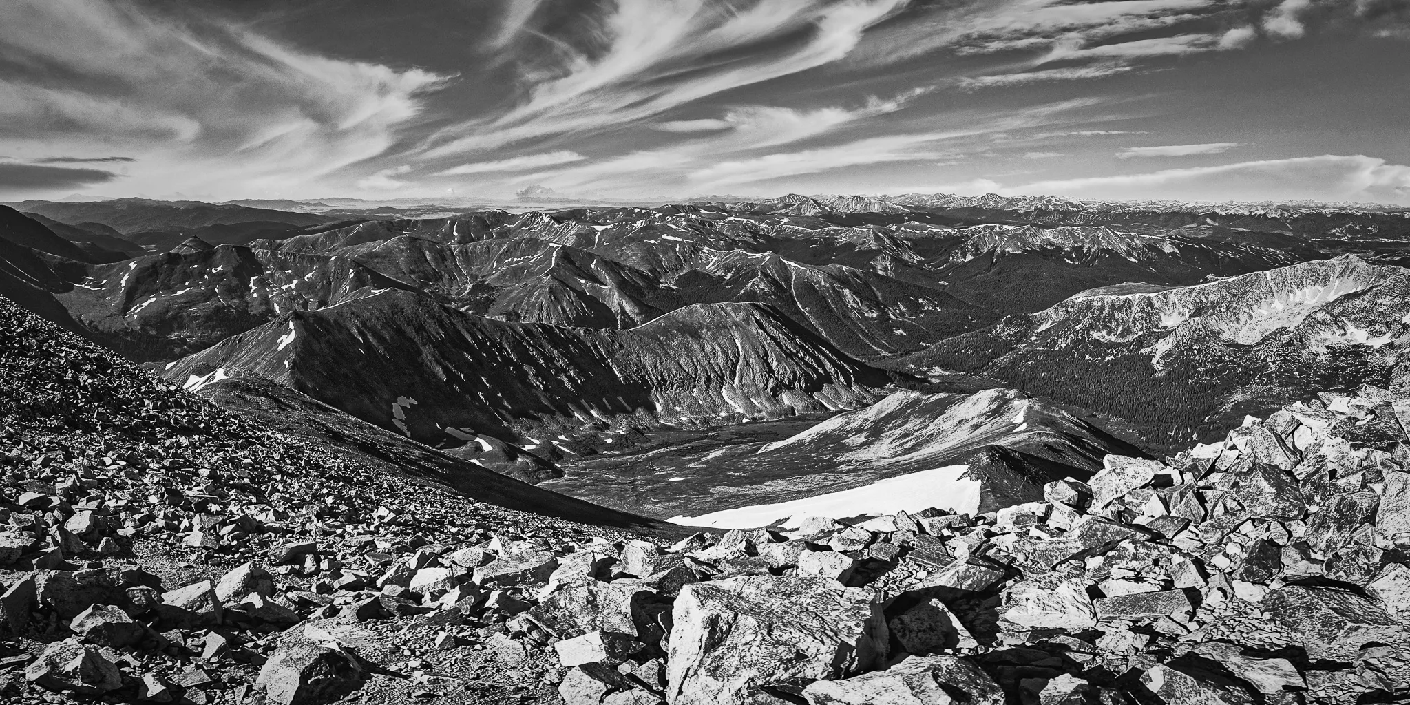
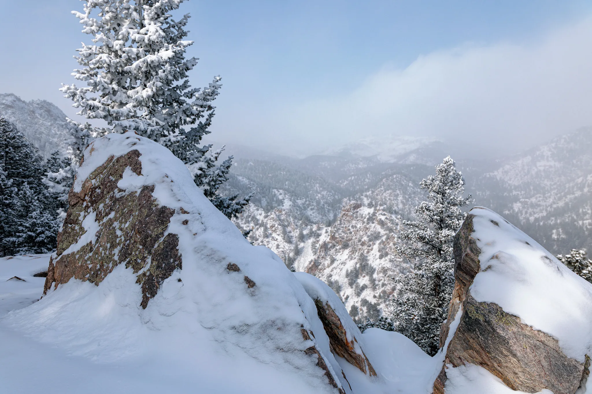
- Best seasons: Spring for green grass and wildflowers on the prairie. Late summer for golden grass at Coalton. Fall for warm light and clear mountain views. Winter for dramatic snow-covered prairie against the Flatirons.
- Wind: Superior's open prairie locations are exposed. Afternoon winds are common, especially March through May. I schedule sessions for evening hours when the wind typically drops. Bring a hair tie.
- Combining locations: South Rock Creek and Coalton Trailhead are about a five-minute drive apart. I sometimes split sessions between the two for variety: prairie rolling hills at South Rock Creek, then taller native grass at Coalton.
Frequently Asked Questions
What is the best photo location in Superior?
South Rock Creek Open Space is the top pick for wide-open Flatirons views. The 3.5-mile loop trail crosses rolling prairie hills with an unobstructed panorama of the Flatirons to the west. For a more intimate setting with water, Purple Park offers two ponds, a creek, and large shade trees.
Where is the Coalton Trailhead?
The Coalton Trailhead is managed by Boulder County Parks and Open Space and sits on the western edge of Superior. It connects to the Coalton, Mayhoffer Singletree, and Meadowlark trail systems. Access is from CO-170 (McCaslin Boulevard). The trails head west into open grassland with mountain views.
Is the Community Ditch Trail in Superior?
The Community Ditch Trail runs along a historic irrigation canal between Superior and Boulder. The City of Boulder describes it as having 'some of the most glorious views' in the trail system. The eastern end is accessible from Superior, and the trail follows the canal west with panoramic Flatirons views.
Are Superior's trails good for families with young kids?
Yes. South Rock Creek and the Coalton trails are packed gravel and gentle. Purple Park has paved paths, a playground, and contained areas where kids can explore safely. The Rock Creek Regional Trail is fully paved and flat, making it stroller-friendly for its full 12-mile length.
Photography Services
These services connect to the topics covered in this guide.
Have a question about your session?
I am happy to help. Send me a message and let's figure out the details.